Hike: Tunnel Mountain, Banff National Park, Alberta Canada

Quick Summary

Difficulty: Easy
Distance: 2.4 Km each way
Elevation gain: 300 m (?)
Time Taken: 1.5 hrs - going slow.
Cool points: View of Banff Town sites
What it's Not: A full day hike
Date of Hike: Summer 1998
Recommendations:
Notes: Don't need much for this hike, just a small day pack, can eat in Banff. Lots of people on this trail, we saw at least 20.

Map

"Map is © Her Majesty the Queen in Right of Canada, Department of Natural Resources. All rights reserved."
map from the website http://toporama.cits.rncan.gc.ca/toporama_en.html

How to get to the trail head

The trail head for this hike is in the town-site of Banff, on the east of the town.

Ramble on about the hike

This hike came about when two friends and I drove to banff for the evening. In Banff we had just finished an early supper at the Hard Rock cafe, So it was late, I was stuffed with a heavy burger and fries, and we decided that Tunnel mountain would be our destination for the day. It looked like a pretty short hike that might give some reasonable views. We could see tunnel mountain from the Hard Rock, and it was pretty easy to drive strait to the trail head. The first part of the hike is actually through a bit of the town, you are on a wide well kept trail as you traverse through the trees up the hill. After about 10 minutes you cross another road, which appears to be used as a secondary trail head.

Banff spring hotel from tunnel mountain

The trail continues to traverse up the hill, you have a continual view of the town site in the initial part of the climb, When we were there, you could see much of the recent construction that had gone on in Banff. This by the way is quit the political issue as I type this, hopefully the park will not let the town expand any more. You can see in the picture some of the new sections of town and the Banff Springs Hotel, this is located on the side of Sanson Peak. This portion of the trail is the hardest in terms of the grade.

The The trail then swings around and follows more or less up the south ridge of the mountain. From here you will see the backside, which included the banff golf course, you get a great view from here of the 'Y' where the bow river splits to make a fairly large island. Oh, and the backside is a pretty impressive cliff, considering Tunnel mountain is not that high. We were able to spot a large Elk crossing the Bow river down below (maybe even a Moose, the distance made it hard to tell.)

View to the East from tunnel mountain

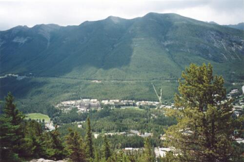
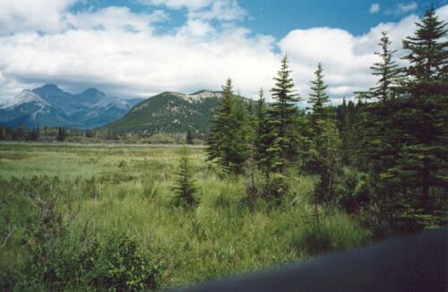
In the picture to the left can see part of the view from the backside of tunnel mountain, Off in the distance you see the Fairholme Range, down below you see the bow river, and a small piece the Banff golf course. To the side is mount Rundel

Part of Banff from the top

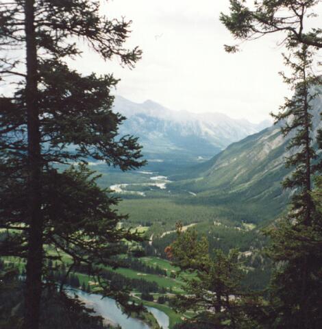
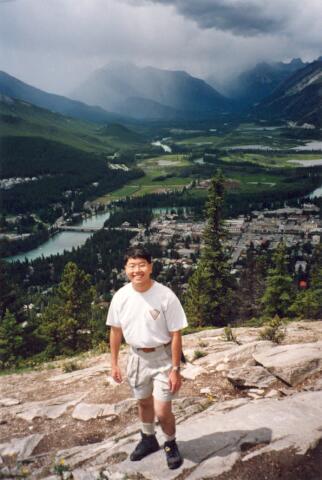
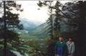
Finally you come over the top, from here you again have a view of the town site of Banff, and in addition you have a view to the north. In the Picture you see one of the hikers I was with (Ben), below you see the northern section of the town of Banff.

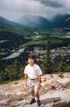
In the last picture you get to see a picture of the 'mountain' that is the topic of this hike. The picture is taken from the trial around the cave an basin national historic site. I saved this picture for last, so you would actually still be interested in the rest of the hike.

Tunnel mountain from the valley

in all fairness, although I listed this hike as easy, it is fairly steep in places, it is the shortness of the hike that places it in the easy category for me. It would be a pretty long haul for a little tyke.

Lessons Learned on this trip.

Not much to exciting happened on this hike. It did threaten with some crummy weather, we heard thunder from up the valley. But other than a light sprinkle no real dangerous weather developed. It is a good reminder that the weather can turn very fast in the mountains, it for us to don our wind breakers, and stay alert for the dangerous stuff that could have easily been on our way. [an error occurred while processing this directive]

Back to TrailCafe Canoeing Back to TrailCafe